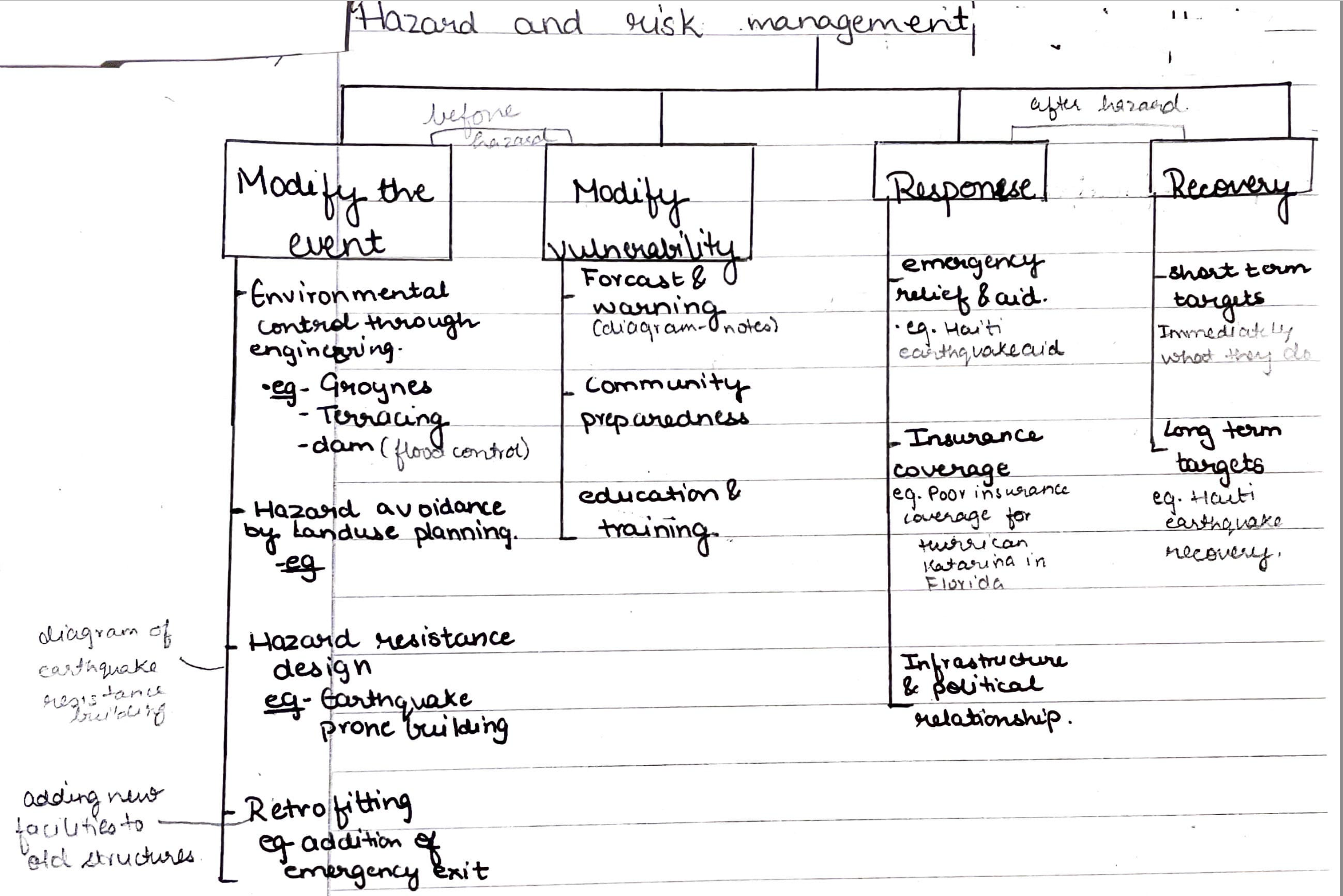
Hazard Management
Pre-event management strategies
Post-event management strategies (rescue, rehabilitation, reconstruction)
Prev
Next

| Hazard | A threat (whether natural or human made) that has the potential to cause loss of life, injury, property damage, socio economic disruption and environmental degradation. | |
| Hazard event | The occurrence of a hazard, the effect of which change demographic, economic and/or environmental conditions. | |
| Hazard Risk | The probability of a hazard event causing harmful consequences (expected loss in terms of deaths, injuries, property damage, economy and environment). Risk is calculated using the formula - R= H x P x V where R is risk (expression as the number of deaths), H is the hazard (measured by its frequency and strength), P is the population size of the exposed area,V is the vulnerability of the population, a factor that depends on the social-economic and political factors. Hazard risks depends on the Economic factors- level of development and technology. Social factors- education and gender. Demographic factors- population density and structure. Political factors - governance and political relationship. | |
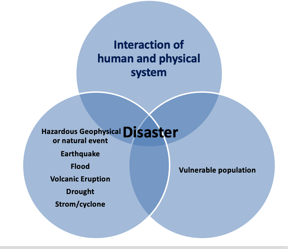
| Disaster | A major hazard event that causes widespread disruption to a community or region that the affected community is unable to deal with adequately without outside help. When human activity and physical processes do not interact, there is no disaster. For example- a volcanic eruption in a remote uninhabited island or a avalanche in a remote unsettled area will not be considered as a disaster. | |
| Hazard Vulnerability | The susceptibility of a community to a hazard or to the impact of a hazard event. | |
| Factors affecting the impacts of geophysical events | 1. Magnitude and frequency of the event 2. Population density 3. Composition of the population (youthful or elderly population 4. Local infrastructure - building conditions, roads and airports for the evacuation and rescue efforts 5. Time of the day 6. Level of economic development 7. Local geology and physical landscape 8. Triggering of the secondary hazard events etc. | |
| Ways of predicting and monitoring earthquakes | 1. Small scale movements, subsidence, tilt or uplift along the fault line detected by Leser reflector or creep meter. 2. Changes/anomalies in the earth's magnetic field measured by Magnetometer. 3. Changes in the Radon gas concentration in the ground water- the amount of radon gas dissolved in the ground water has been shown to increase before major earthquakes. 4. Unusual animal behavior etc. | |
| Ways of predicting and monitoring volcanic eruption | 1. Leser reflector, GPS satellites and remote sensing techniques to monitor swelling of the crater 2. Aircrafts, drones using chemical sensors to measure the increase sulphur level in the atmosphere. 3. Swarms of tiny earthquakes to record using seismometers. This may happen due to the increasing stress as the magma rises from the magma chamber. 4. Changes in electrical resistance of the local rocks | |
| Ways to reduce risks associated with landslides/mass movements | Drainage of water from slopes: i) This increases the shear strength of materials by reducing the pore-water pressure. ii) decreases the risk of liquefaction where the entire ground starts moving causing severe landslides. Terracing steep slopes: This act as a break of slopes that helps in i) reducing the steepness or gradient of the land by producing more stable angles. ii) It reduces the speed and onset of landslides. Building retaining structures such as stone walls, steel mesh curtains, rock anchor etc. Erosion control at the base of the cliff using stabilization methods: such as retailing walls or baboons and earth fill. Diversion of roads from the active areas of landslides or tunnel building. |